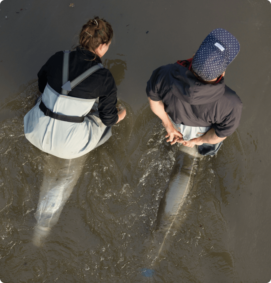
We combine ecological and hydromorphological field surveys with remote sensing. Our field expertise includes the assessment and analysis of macrozoobenthos and habitat structures such as grain size, shore lines, colmation and temperature. Using state-of-the-art acoustic 3D flow and discharge measurements deploying Acoustic Doppler Current Profilers (ADCP) in combination with visual remote sensing, we assess large-scale and complex habitat structures or bedload dynamics in and along watercourses as well as their dynamics, in detail and effectively. This data allow the integrative assessment of aquatic ecosystems.
Our Services in Detail
Hydromorphological Field Surveys
We carry out comprehensive surveys, analyses and impact monitoring of various hydromorphological indicators, including habitat diversity, grain size distributions, bank morphologies, flow velocities and temperature variability. The scope of these investigations we adapt individually to your project requirements.
Ecological Field Surveys
We offer you surveys and analyses of macrozoobenthos communities and algae growth. Since the analysis of biotic communities requires special expertise depending on the level of determination, we work closely with the relevant experts to ensure a high quality of assessment and evaluation with these indicators.
Acoustic Remote Sensing
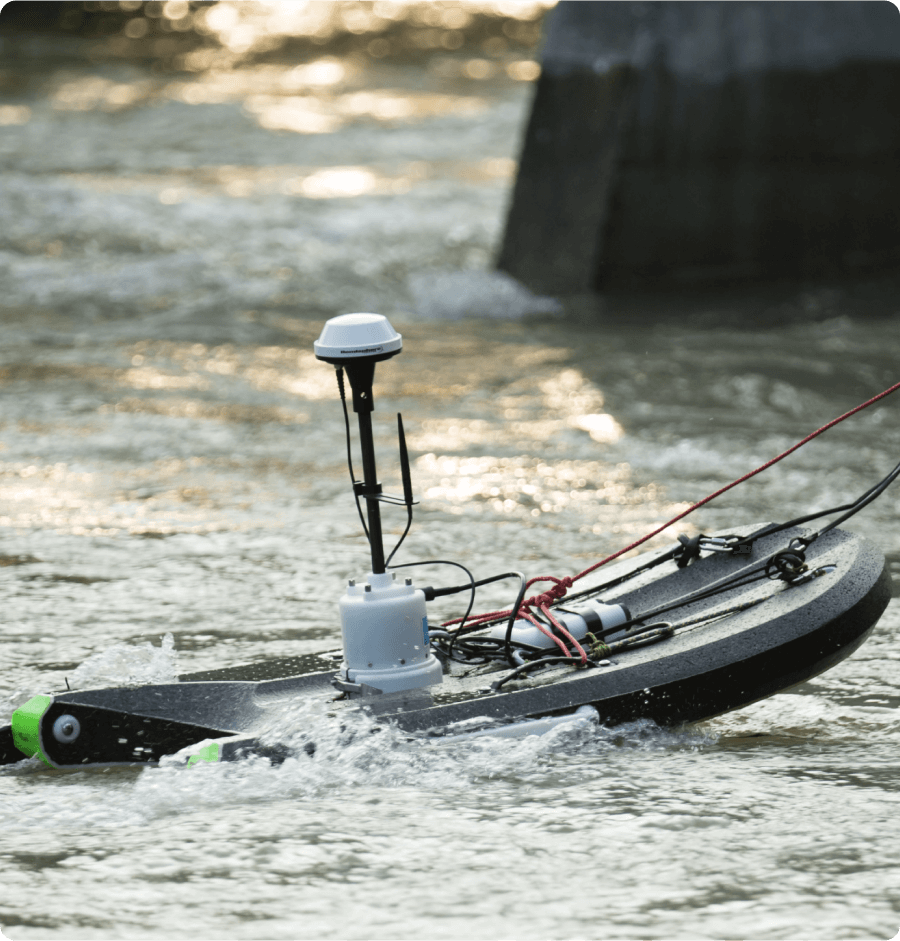
We use state-of-the-art Acoustic Doppler Current Profilers (M9, SonTek) for 3D flow measurement, assessment of river bathymetry and determining the total flow rate. This enables high-precision discharge measurements even at high water levels and the detailed spatial flow conditions to be mapped.
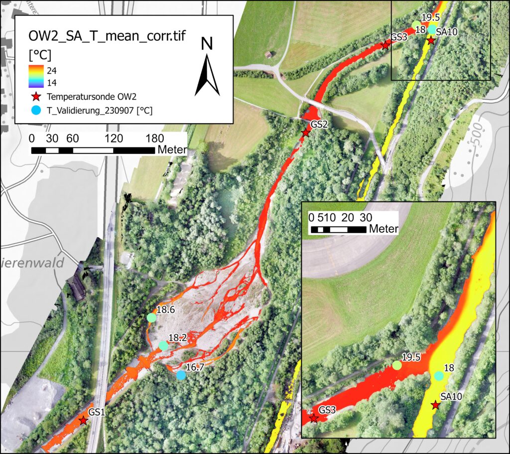
Visual and Thermal Remote Sensing
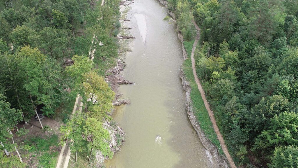
We use fixed wing drones (eBeeX; AG Eagel) for high-resolution ortho- and temperature imagery (RGB/NIR and thermal infrared) as well as for surface model generation. The flexible deployment on demand allows large-scale assessments and analysis of habitat and bedload dynamics, temperature heterogeneity or groundwater surges.